
Frequently Asked Questions
-
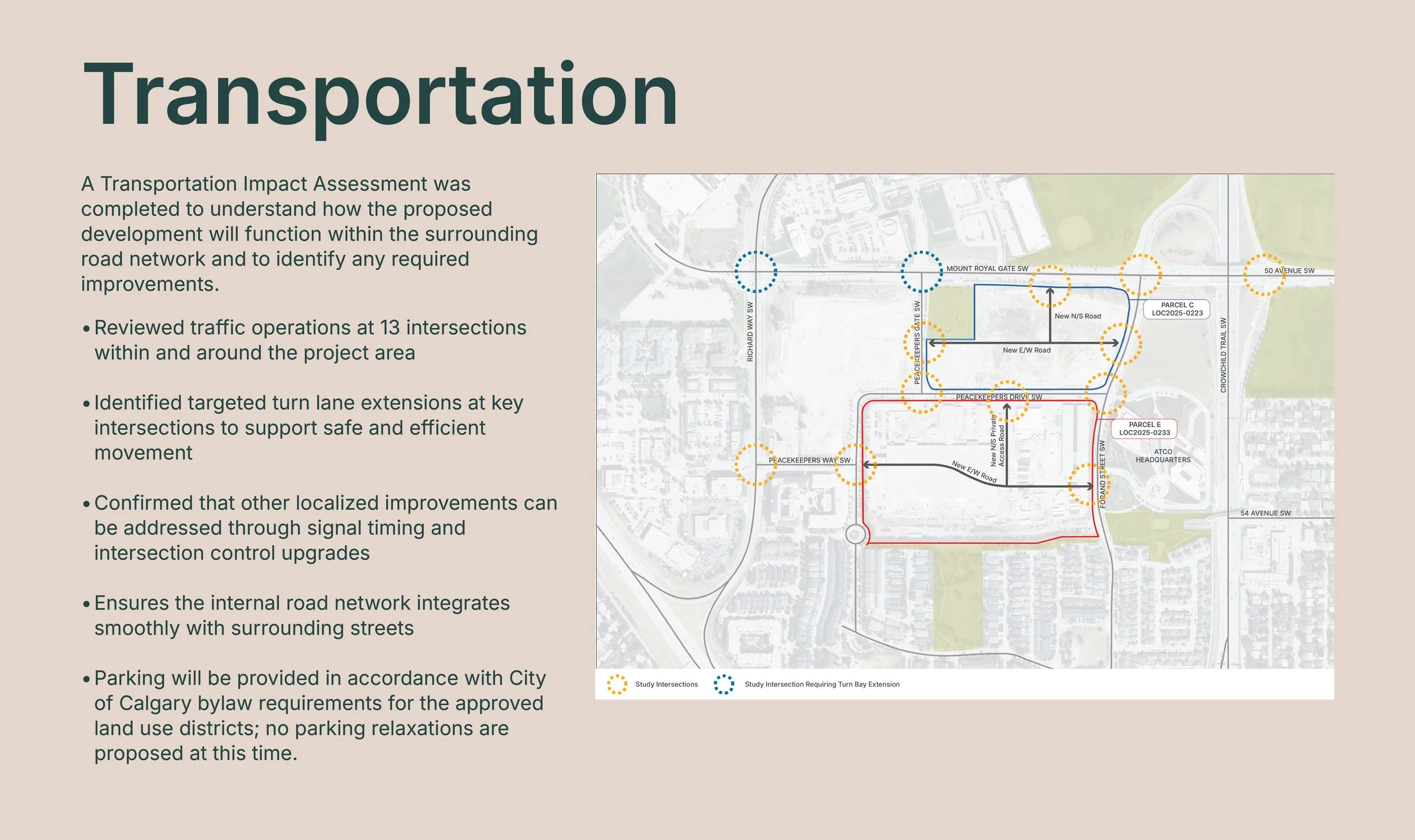
A Transportation Impact Assessment (TIA) has been completed to evaluate anticipated travel demand, intersection performance, and the proposed internal road network. The study reviewed 13 intersections within and adjacent to the site and concluded that the surrounding road network is generally operating well. Two intersections - Richard Road / Mount Royal Gate SW and Peacekeepers Gate / Mount Royal Gate SW - were identified as requiring targeted improvements, specifically turn bay extensions, under both current and future conditions. No broader road expansions or network upgrades are anticipated beyond these localized improvements.
-
Parking will be provided as part of future development applications and will comply with the City’s Land Use Bylaw requirements for each approved use. The overall plan anticipates a combination of on-street parking along new internal roads and consolidated underground parking structures to serve residential and commercial uses. Detailed parking layouts and quantities will be finalized at later stages as individual buildings are designed and reviewed by the City.
Transportation & Parking
-
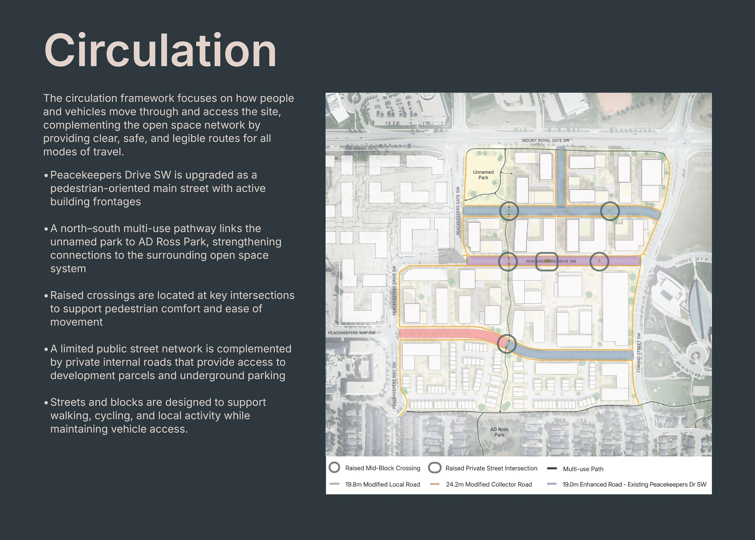
The development will enhance pedestrian access by adding new sidewalks, improved crossings, and a multi-use pathway that links AD Ross Park with the park at Peacekeepers Gate SW and Mount Royal Gate SW. Existing pathways will be integrated into the new street network, strengthening connections within the site and to surrounding parks and destinations.
-
While there is no LRT station immediately adjacent to the site, the development is within walking distance of two MAX BRT stations and several regular bus routes. These connections provide frequent and convenient access to downtown and surrounding areas. The site’s pedestrian-oriented design, combined with nearby transit options, supports a walkable, connected community consistent with transit-oriented principles.
Active Transportation
Community Infrastructure & Public Services
-
The proposed development is currently under review by the City and relevant utility providers as part of the outline plan and land use application process. To date, no major infrastructure or servicing constraints have been identified. The City’s review will determine whether any localized upgrades are required as the project advances to more detailed stages.
-
Local school boards are circulated as part of the City’s application review process. They are aware of the proposed development and will determine how future student populations are accommodated based on their long-term planning and capacity strategies.
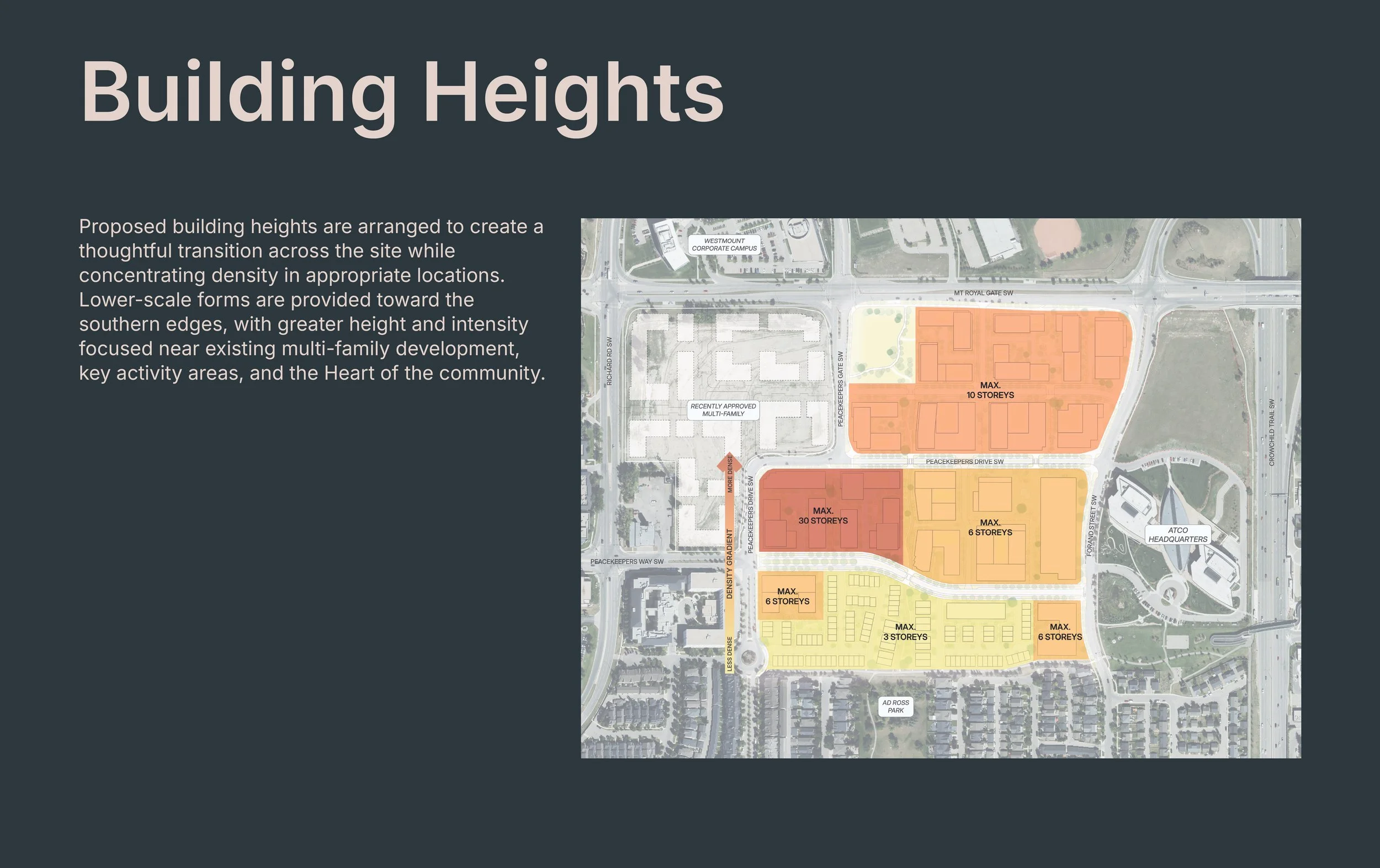
Built Form, Height, & Neighbourhood Transition
-
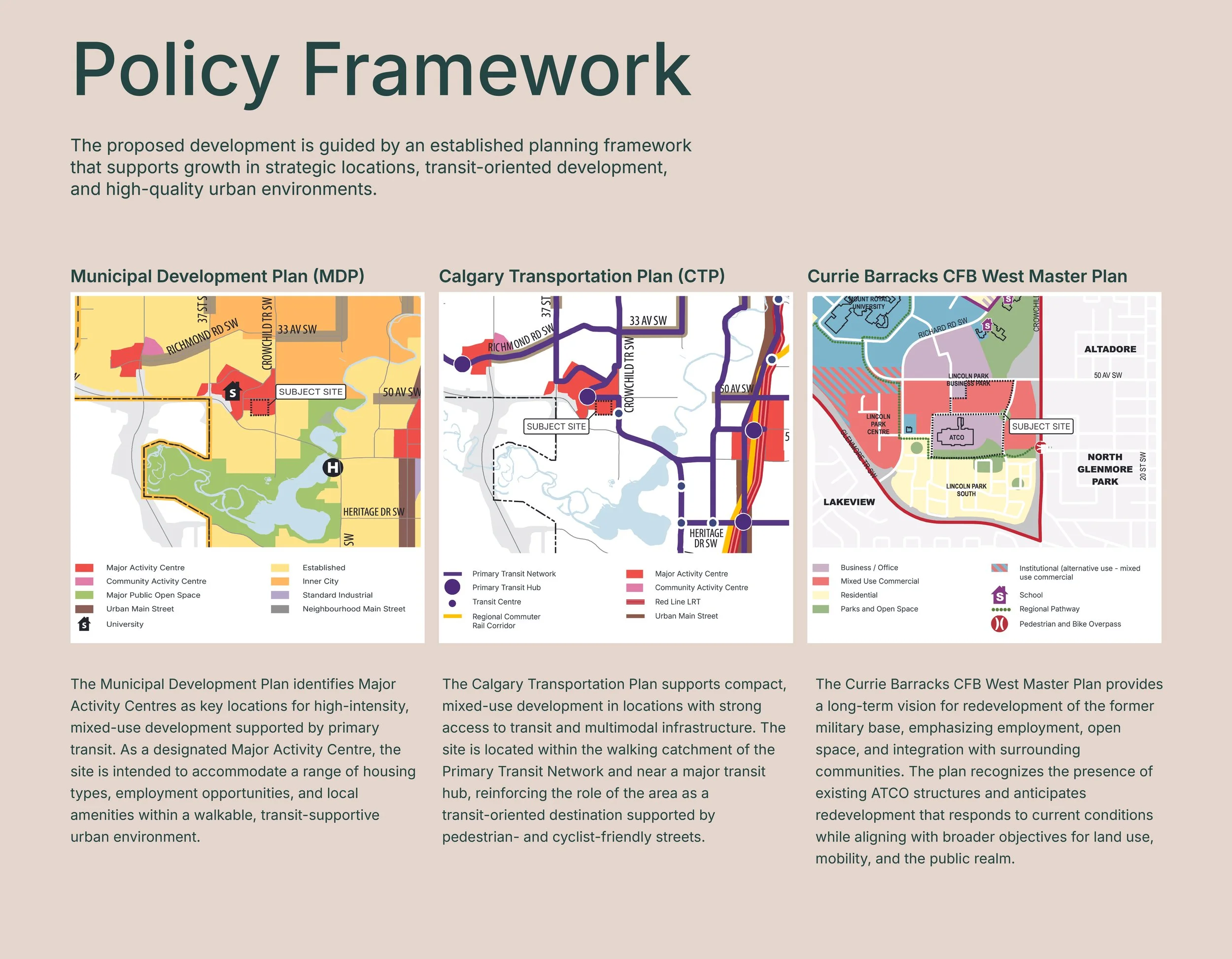
The site has long been identified for redevelopment and is designated as a Major Activity Centre in Calgary’s Municipal Development Plan. This policy framework supports higher-density, mixed-use development in areas with strong access to transit, major roadways, employment centres, and institutional uses such as Mount Royal University. Taller buildings are strategically located away from lower-scale residential areas, with density distributed to minimize impacts and create a diverse mix of housing types across the site.
-
Building heights step down toward Garrison Green, with lower-scale forms - such as three-storey buildings - located along the interface with the existing neighbourhood. Higher densities are positioned internally or adjacent to other multi-family or institutional uses, creating a gradual and intentional transition in scale.
-
Yes. Market and retail studies completed for the site indicate strong potential for a range of local amenities and services. While specific tenants and uses will be confirmed at later stages, the intent is to include amenities that support daily needs and contribute to a lively, complete community. The final mix of uses will be guided by market demand and future development approvals.
Amenities & Daily Needs
-
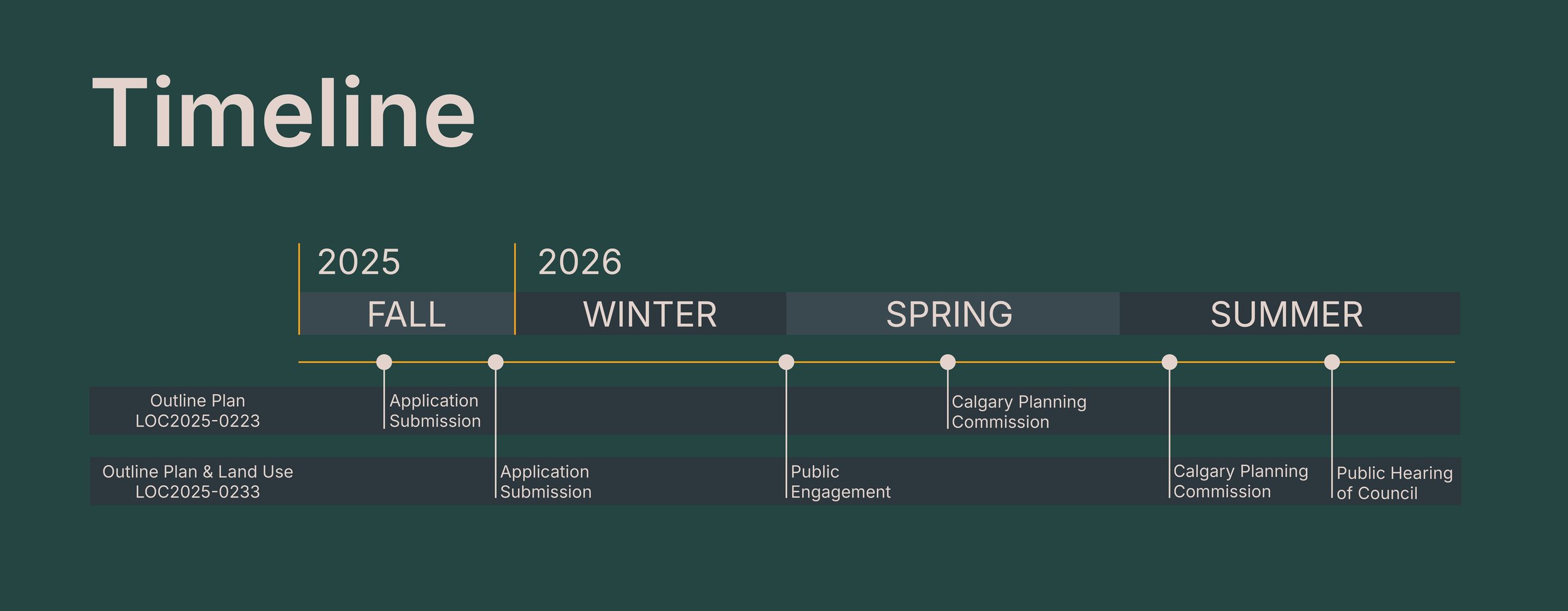
Planning applications for the site have been submitted and are currently under review by the City. A land use amendment and outline plan process typically takes approximately 8 to 12 months. At this time, the application (LOC2025-0233) is anticipated to be considered at a public hearing in late summer or early fall 2026.
-
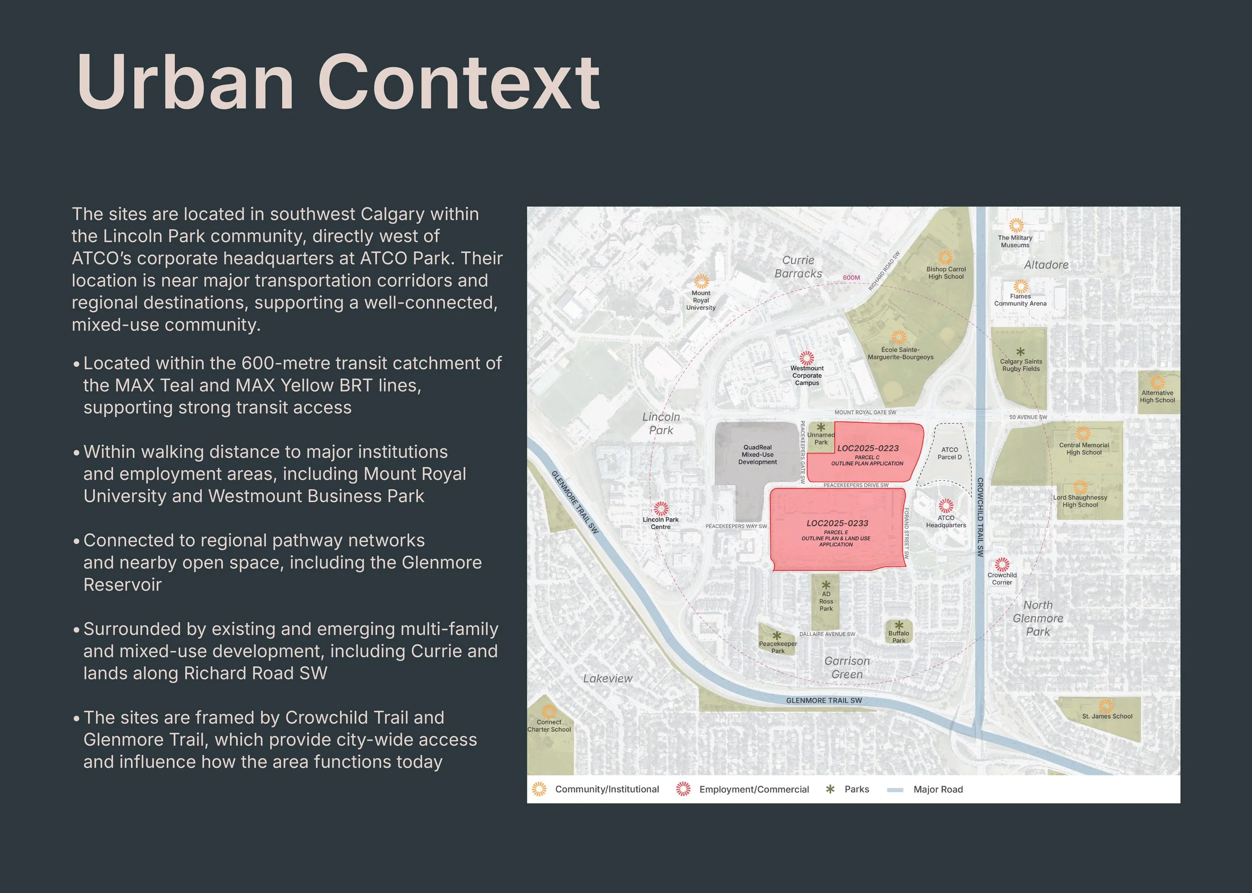
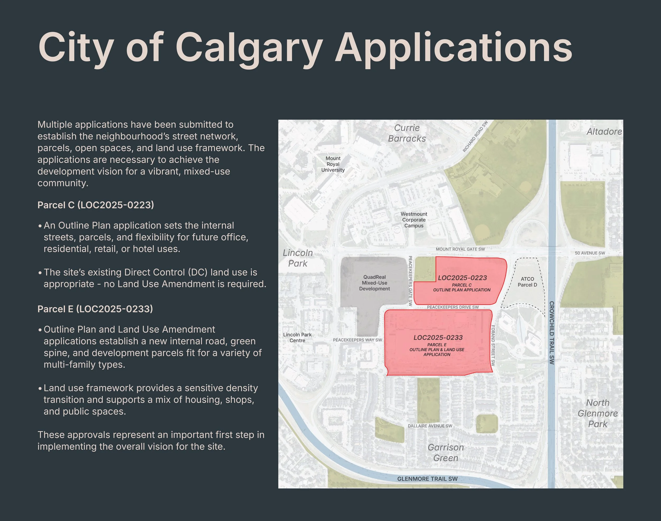
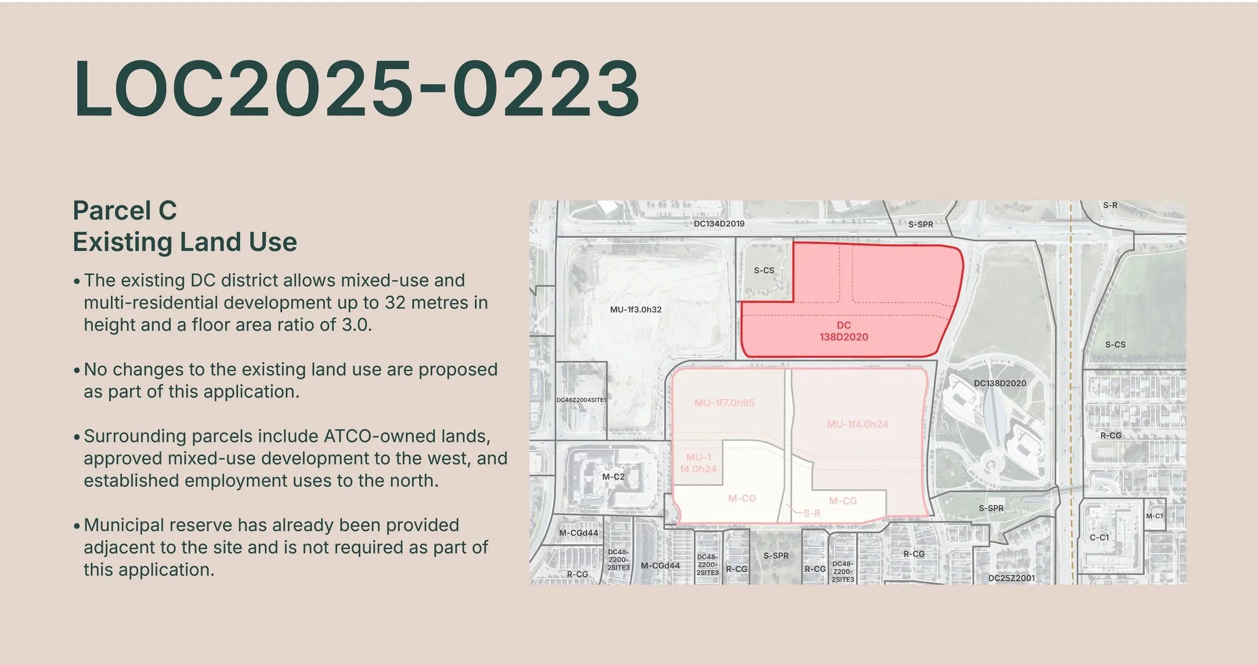
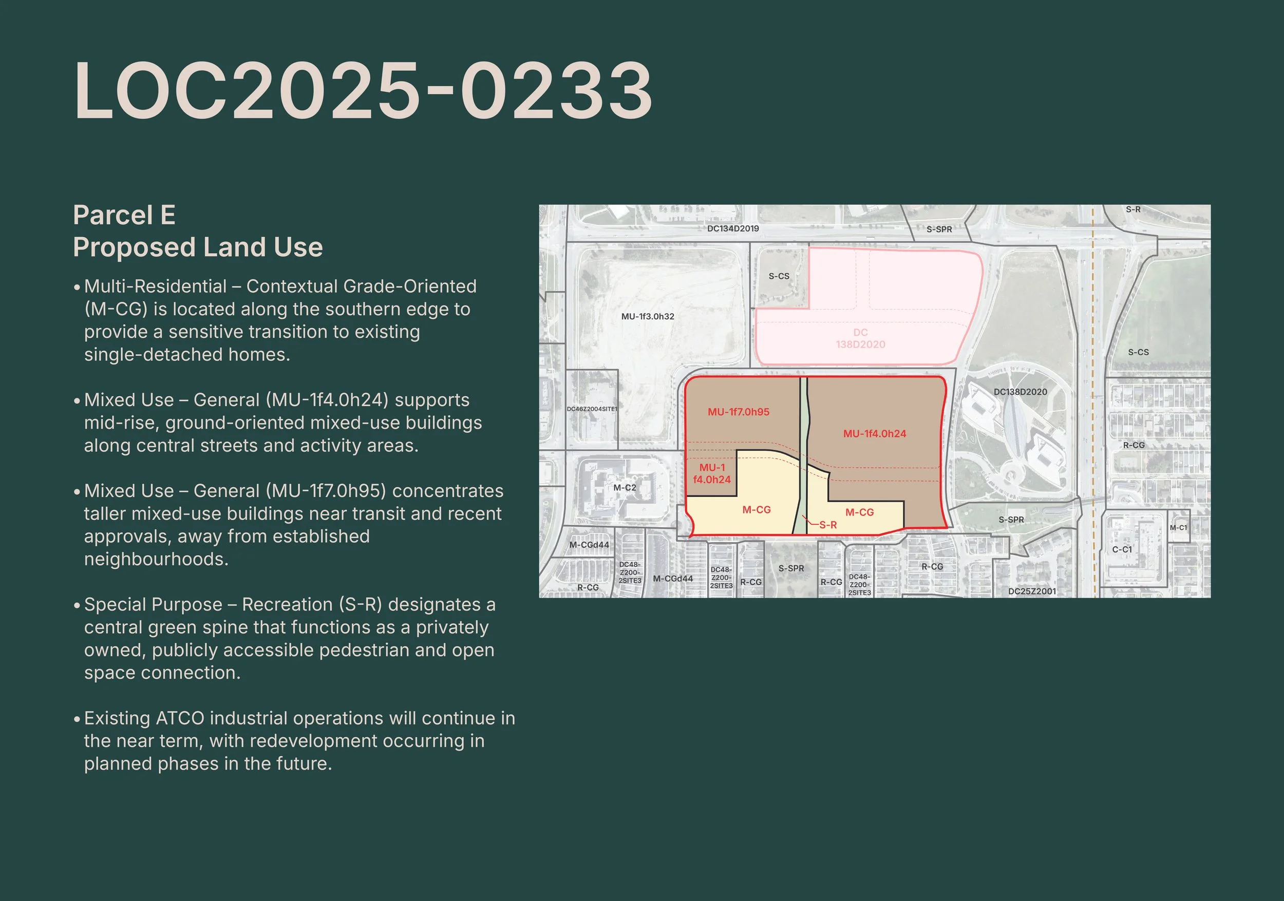
This phase of public engagement is focused on the proposed ‘Parcel E’ land use and outline plan application (LOC2025-0233) under review by the City of Calgary. Additional planning information, including the ‘Parcel C’ outline plan application (LOC2025-0223) is shared to provide context and help explain the long-term vision for the site, but it is not part of the current engagement process.
-
Community feedback is welcomed throughout the City review process. Comments and questions can be submitted through this project website or via the project email. Input received will continue to be shared with the project team and considered as the applications progress through City review and toward decision by Calgary Planning Commission and City Council.
Planning Process & Engagement

Website by O2 Planning and Design